Old School Navigation in a Digital World
PUBLISHED 2026-09-24 | BY Jesse Pisel
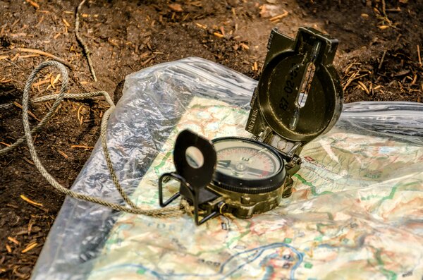
Photo by Thomas Thompson on Unsplash
Where are you?
Juniper and piñon perfumed the dry air. I stood by Dad’s truck, the warm hood radiating heat under my hands. He spread a topo map across the metal, its creases soft from years of use. Mesas rose like islands from a sage sea. Arroyos cut deep into the earth. Wind rustled through the short trees.
“We’re right here,” Dad said, tapping the map. “But the map doesn’t know that yet. We have to show it.”
I fumbled with the compass, small fingers struggling with the bezel. Squinting at a distant ridge, I tried to align the needle with the orienting arrow. My first bearing was wrong. Dad did not laugh. He guided my hands and said, “Again.”
Then it clicked. First bearing to a peak, second to a saddle, the lines converging at our location. “You’ve just found yourself without anyone telling you where you are,” Dad said. His pride matched my own.
Dad was an outdoorsman who knew the land and a technologist who understood tools. He believed in true understanding over mere use. That high desert day, he gave me more than a skill. He gave me a way of seeing.
The Craft of Triangulation
Triangulation finds your location by measuring angles to known points. The principle stretches back millennia. Egyptians documented triangular plot calculations in the Rhind Mathematical Papyrus (c. 1650 BCE) after Nile floods. Hero of Alexandria later formalized these in “Dioptra”.
At its heart, triangulation is trigonometry, the law of sines. Measure two angles from your position to known landmarks, calculate your location. A third bearing tightens the fix.
The tools are simple, no subscriptions required.
A topo map renders the land in two dimensions. Contour lines trace elevation, scales mark distance, symbols denote features. According to the USGS, 7.5-minute quadrangles cover 49-70 square miles each with standardized symbols.
A baseplate compass with its rotating bezel looks simple. The needle finds magnetic north while the bezel sets bearings. According to US Army FM 3-25.26, quality instruments adjust for declination, the shifting gap between magnetic and true north.
The workflow is one of deliberation. Orient the map to terrain, pick landmarks visible on both ground and paper, take bearings, transfer lines to map. Where they cross is where you stand. Compass precision, map scale, misidentified features, or shifting magnetic declination cause errors.
In the high desert, every juniper hill and pinon stand becomes a potential reference point. I still remember Dad’s patience through my early missteps, and the quiet satisfaction when those lines finally settled on our position.
The Other Ways to Find Yourself
Map and compass form only part of the toolkit. For millennia, travelers have used more fundamental methods.
Soldiers count paces (60 to the 100 meters), tracking pairs with beads to prevent losing count.
On a winter fatbike trip below zero, an old-timer shared his secret by the fire with me. “Keep the wind in your face. You will keep moving upriver in the middle of the night when you have nothing to look at”. Great advice for rivers that are miles wide and impossible to see past the glow of a headlamp at 2 am since the thermals always go down river at night. The approach is simple, reliable, and requires no batteries.
The sun offers its own bearings. At solar noon in the Northern Hemisphere, it hangs due south. The shadow-tip method is straightforward. Plant a stick, mark the shadow’s end, wait 15 minutes, mark again, draw the line between for an east-west reference.
After dark, Polaris waits. The North Star sits within a degree of true north. Find the Big Dipper’s bowl, trace a line through its outer stars, extend that line five times their separation. There it is. Geometry helps you understand how the star’s elevation above your horizon matches your latitude.
Nature provides subtler clues. Such as junipers lean away from prevailing winds. Snow melts first on south-facing slopes. Animal trails trace the path of least resistance, often leading to water. Here is my favorite book for learning to read the signs
These methods long predated GPS. They still work when the satellites go silent. They connect you to the land in a way no device can. The earth speaks. You need only listen.
What Old School Navigation Teaches That Digital Doesn’t
Traditional navigation builds skills GPS cannot replicate.
Consider spatial reasoning. As this study of London taxi drivers documents, memorizing “The Knowledge” develops measurable hippocampus changes, the brain’s spatial memory center. Additional research finds orienteers treat navigation as a cognitive-motor skill as refined as any physical discipline.
Traditional navigation demands continuous observation of terrain, vegetation, drainage, and light. The US Army Land Navigation manuals I linked above demonstrate pattern recognition builds beyond what turn-by-turn directions can match.
Triangulation forces patience. Careful observation, precise measurement, methodical verification require discipline. According to Outward Bound, this deliberate approach cultivates discipline and curbs the impulse to rush.
With map and compass, you make the decisions. You interpret the information. You accept the responsibility. As NOLS notes, this self-reliance builds a quiet confidence that no app can bestow.
Analog navigation carries its own error checking. When bearings fail to intersect, you know immediately something is wrong. You backtrack. You recalculate. GPS errors, however, stay invisible until you are already lost.
Habitual GPS use degrades spatial memory. Users develop worse route understanding and form less accurate cognitive maps than those navigating by traditional means.
A topo map is a conversation with the land.
The Hybrid Approach
The best navigators use both, analog and digital. As NOLS teaches, each excels at what it does best.
Gaia GPS, CalTopo, and similar apps combine offline GPS tracking with traditional terrain visualization. You get satellite precision layered over contour lines. The best of both worlds.
Phone compass apps serve as emergency backups. As Apple notes, device interference limits their accuracy compared to dedicated baseplate compasses.
Satellite communicators like the Garmin inReach provide location fixes, emergency SOS, and a new way to be surveilled. They will not tell you how to reach your destination.
Sometimes trust the analog approach. Deep in the wilderness with no battery replacement, on extended trips where electronics inevitably fail, when teaching fundamentals to beginners, or in conditions where cold, water, or shock disable devices.
Closing
Years later, crouched on an outcrop with a field assistant under a similar high desert sun, I held a geological compass. After finding our position on the map, I demonstrated taking a strike and dip measurement, recording how rock layers tilt relative to horizontal and north.
Then we used the location and structural data to record it in our field notebooks and on our base map. My assistant’s eyes widened with the realization. The hand compass was not merely for show on my belt to look like a real geologist. Reading rocks is its own form of navigation.
The same principles Dad taught me, understanding orientation and interpreting landscape, had helped me read the earth’s history. A geological map is simply another kind of topo map, revealing underground structure and deep time history.
Digital tools deliver precision. Analog tools deliver wisdom. In my work, I use both. GIS for regional analysis across vast areas, hand compass for the intimate details. These days my compass sits next to my field notebooks. Both are worn smooth from years of use. Both are dusted with bits of the desert.
Technology changes. The need to know where you are and where you are going does not.
TAGS: geology adventure