Geoscience Research
AI & Software Development
VOLUME I | 2026
Research Journal
Exploring the intersection of AI, geosciences, and open-source software
Nature writes its own algorithms. A river self organizes into meanders and braided channels. Sediment sorts itself by grain size. These are intelligent systems operating without apparent design. AI models work the same way, learning patterns through iteration and feedback.
I tie field science to Frontier AI models. Outcrop geology provides ground truth. Subsurface imaging gives us the hidden layers. Together with artificial intelligence we connect surface expression to subsurface architecture. The same principles that shape a river valley can train a neural network.
I lead teams of geologists, data scientists and AI engineers to build these connections. Mentorship matters as much as code. A good human makes a better scientist. Open source ensures our models stand on solid foundations anyone can inspect. High performance teams do not happen by accident, they are built on trust, clear thinking and shared purpose. The overlap between natural intelligence and artificial intelligence is where the most powerful discoveries emerge.
AI in Geosciences
Subsurface Prediction
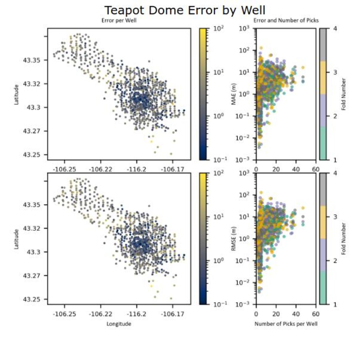
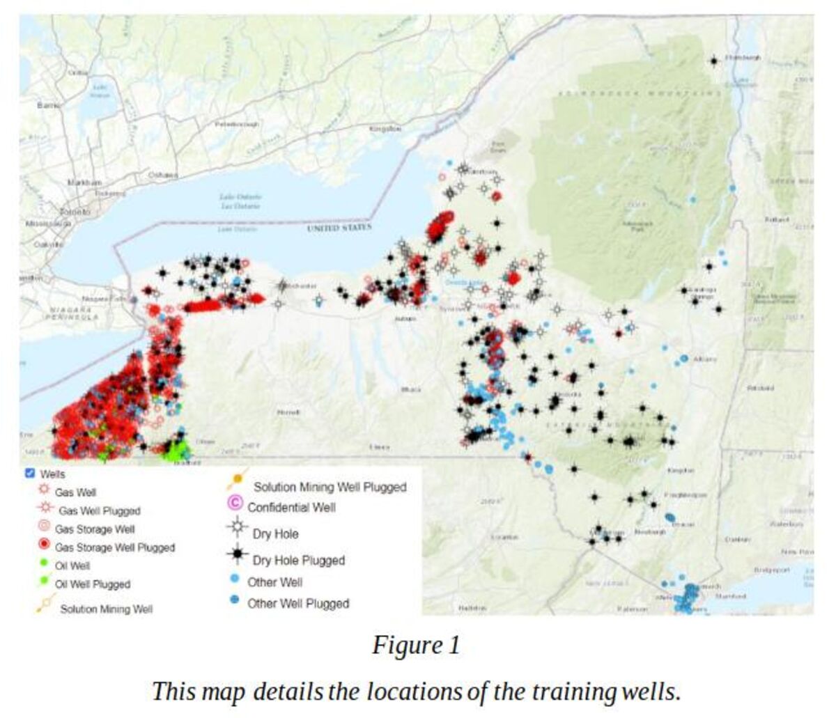
AI recommender systems for predicting true vertical depth to subsurface formation tops, improving oil and gas exploration accuracy.
Basin-Scale Stratigraphy
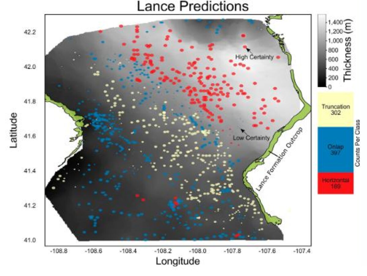
AI approaches for classifying basin-scale stratigraphic geometries from formation tops data, published in The Depositional Record.
Well Connectivity Analysis
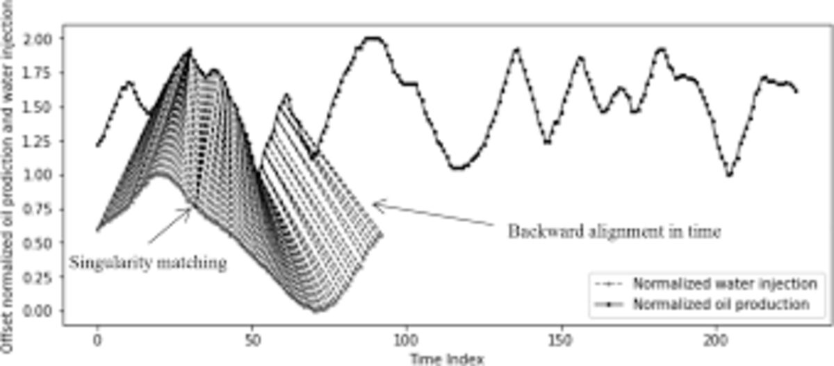
Applied dynamic time warping to characterize connectivity between well injection and production histories in petroleum systems.
Fluvial Systems & Sedimentology
Fluvial Architecture Analysis
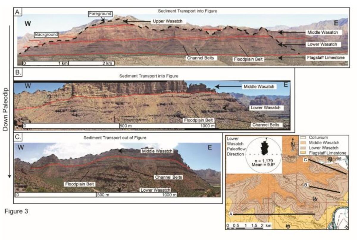
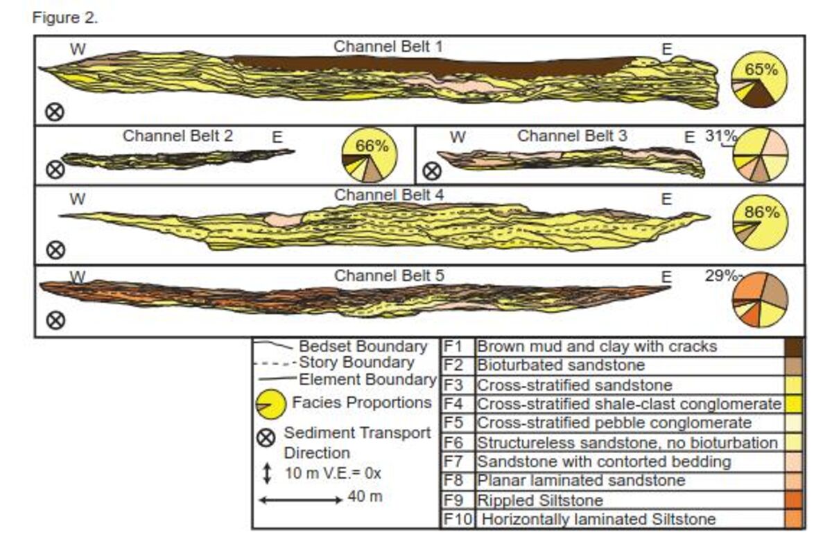
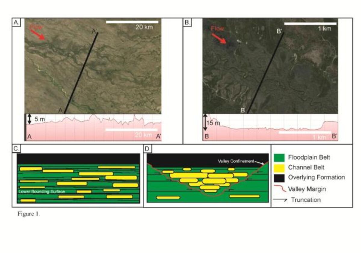
Comprehensive study of fluvial channel-belt clustering, compensation, and connectivity in the Wasatch Formation and Dakota Sandstone.
Quantitative Fluvial Analysis
Quantitative analysis of fluvial paleohydraulics and intra-channel belt stratal preservation in continental sedimentary basins.
Lateral Confinement Effects
Research on how lateral topographic confinement influences fluvial channel-belt clustering and connectivity patterns.
Geophysical Data Analysis & AI
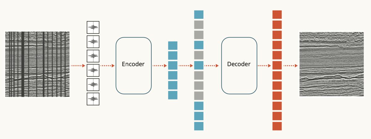
Open-Source AI for Seismics
Developed geophysical foundation models for seismic analysis using deep learning, presented at EAGE conferences.
RES Data Enhancement
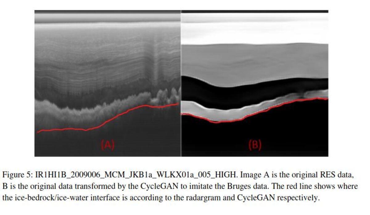
Automatic feature highlighting in noisy resistivity data using CycleGAN generative adversarial networks.
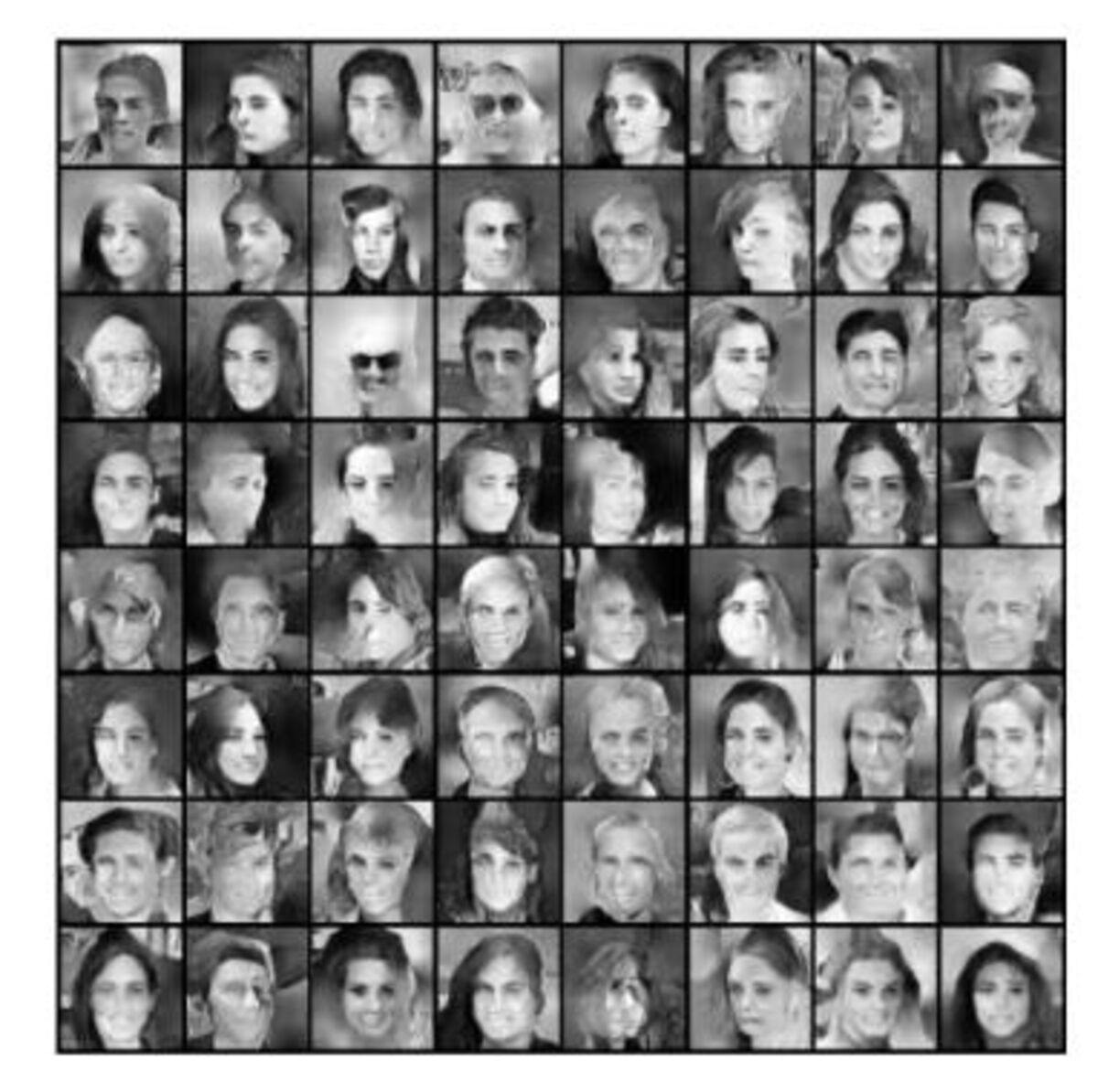
StackGAN Optimizations
Research on StackGAN optimizations for facial image generation with applications in geoscience data visualization.
Energy Systems & Optimization
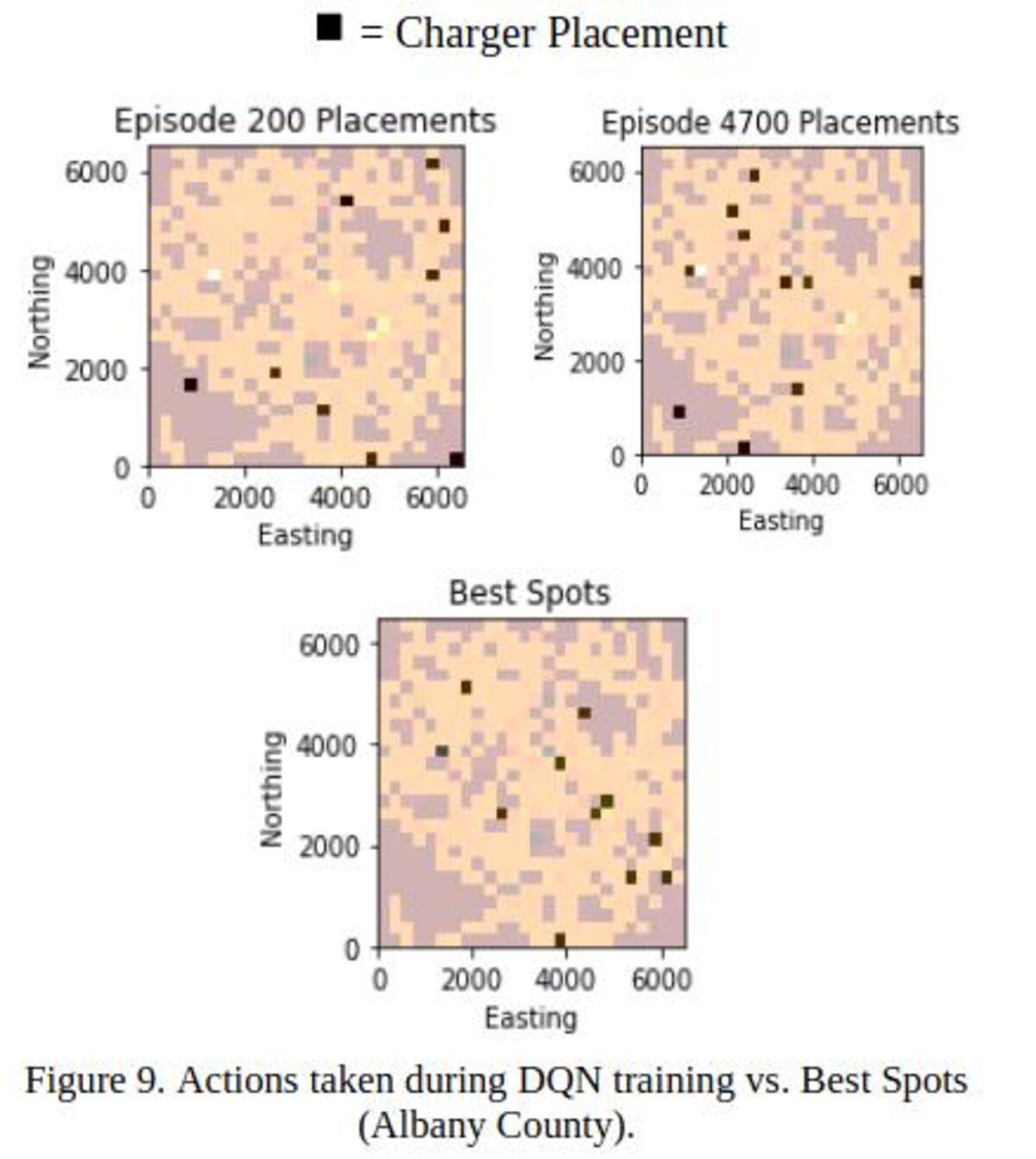
Public Charging Stations
Deep reinforcement learning for optimal placement of public electric vehicle charging stations.
AI for Acquisitions
Recommender systems for optimizing oil and gas acquisitions using AI approaches.
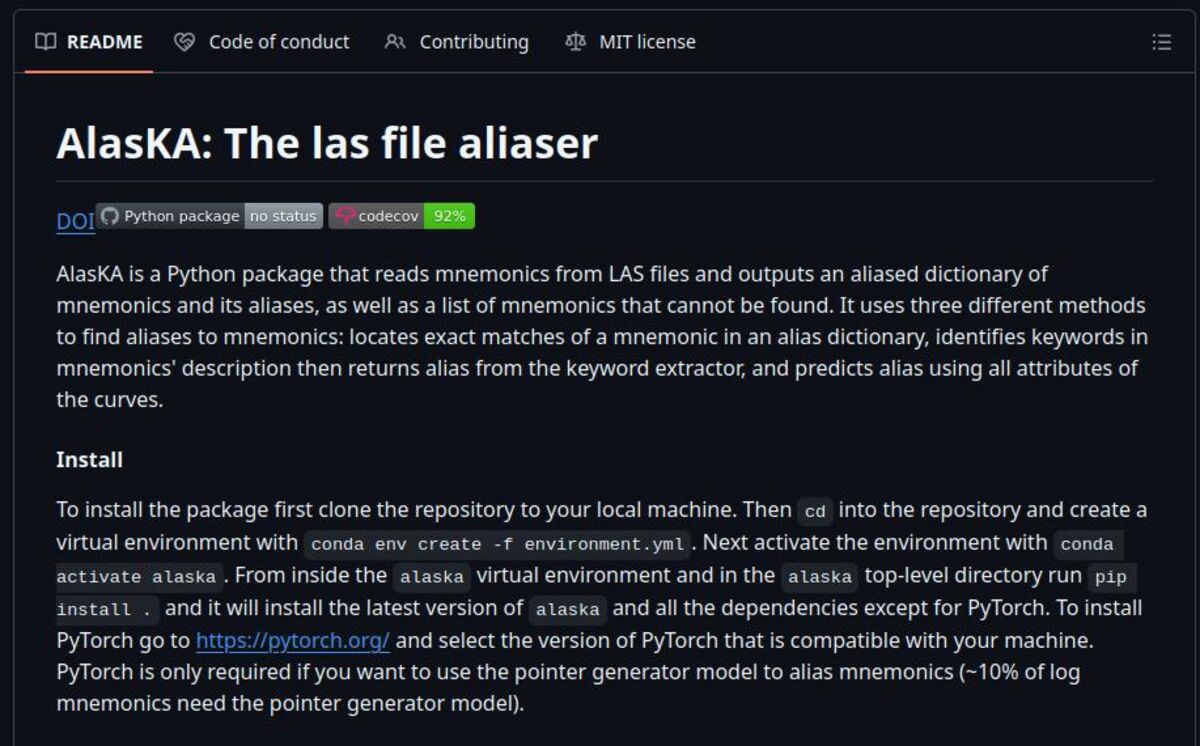
Well Log Aliasing
Digital well log aliaser for petroleum data analysis, presented at Norwegian Geological Society conferences.
Geological Mapping & Regional Studies
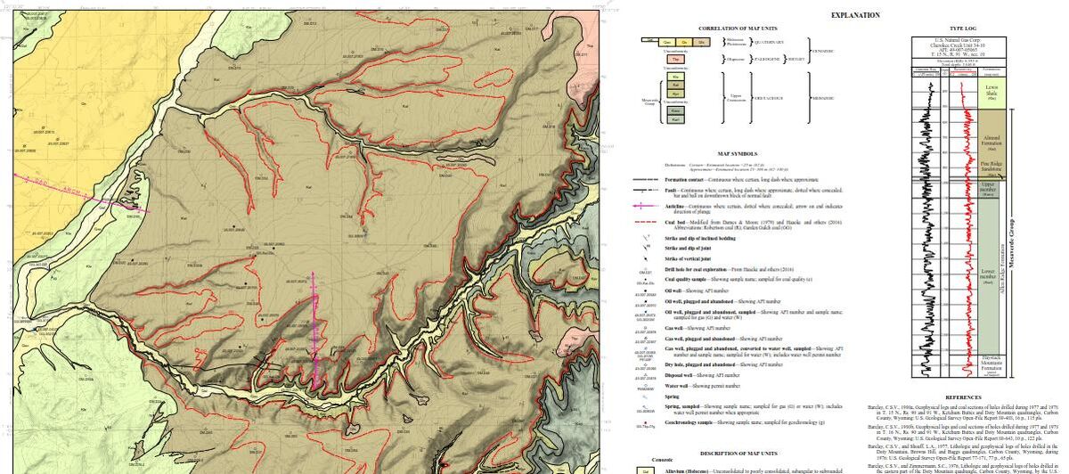
7.5' Quadrangle Maps
Preliminary geological mapping of multiple 7.5' quadrangle areas in mountainous terrain.
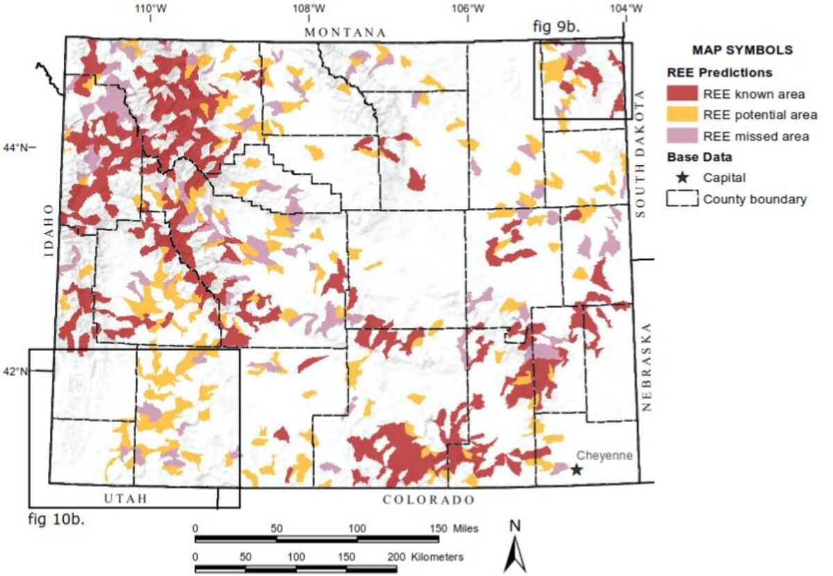
Regional Geochemical Analysis
Regional-scale geochemical investigations from legacy rock and sediment datasets in diverse geological provinces.
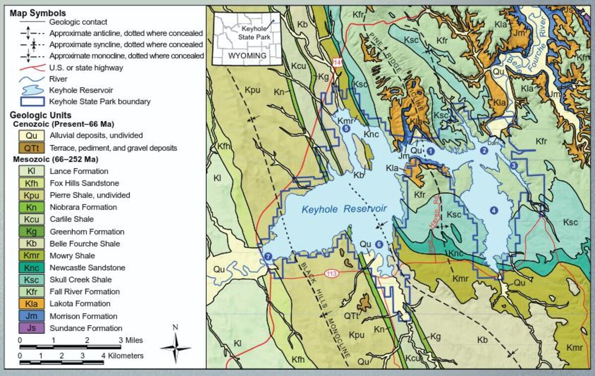
Keyhole State Park
Geological study and educational materials for public interpretation at a scenic state park.
Open Source Software Development
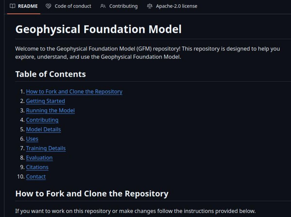
Hugging Face Models
Open-source geophysical foundation models for seismic data analysis, available on Hugging Face with DOI registration.
Spatial Data Libraries
Contributions to Verde (spatial data processing) and Geopandas (geospatial data analysis) open-source libraries.
AI for Geosciences
Matrix factorization library specifically designed for geoscience applications and data analysis.